The parks within North Bay include Thomson Park, Lee Park, Champlain Park, Amelia Park, Armstrong Park, Memorial Park and Steve Omischl Sports Fields Complex. As well, the North Bay Waterfront is a great place to walk, jog, bike or rollerblade. It is close to the downtown, and provides marina facilities, boat launching, access to North Bay's trails by way of the Kate Pace Way, playgrounds, beach areas, picnic areas and a bandshell, all along a landscaped stretch of Lake Nipissing.
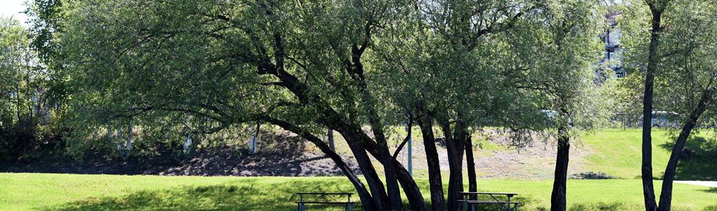
The City has 73 park areas including playgrounds and picnic shelters that provide places for people to relax, picnic, play, walk, blade or swim. While these parks are available to the community, organized activities must have a permit to use the park areas. Playground areas should be used safely and under the guidance of adult supervision.
In 2008 the Parks and Recreation Department updated its Parks Plan through a detailed review and consultation process. In keeping with this plan and ongoing consultation with neighbourhoods and community partners, the City continues to invest in parks through the development of new park areas and improvement of current park facilities.
Summer activities at outdoor rinks
The following outdoor rink locations now feature basketball and/or pickleball courts for drop-in use:
- Circle Lake Park – two pickleball courts (with nets) and mini basketball court
- West Ferris Lions Park – two pickleball courts (with nets) and mini basketball court
- Graniteville Park – two pickleball courts (with nets) and mini basketball court
- Bourke Playground – full basketball court
- Greenhill Park – half basketball court
- Kinette Playground – half basketball court
The City has also designated four outdoor rink spaces as neighbourhood off-leash dog areas in the spring and summer months:
- Sage Park
- Kinette Playground
- Greenhill Park
- Police Playground
Location of Parks
| Park Name | Location | |
|---|---|---|
| Aerospace Defense Park | On Airport Rd, at Little Down Lane | Map |
| Amelia Park & Beach | On Queen Street, at James Avenue | Map |
| Airport Lookout Park | Lookout Heights Place, off Airport Rd. overlooking the City | Map |
| Armstrong Park | On Lakeside Dr | Map |
| Belleview Park | 20 McGibbon Street | Map |
| Birchaven Cove | At the south end of Lakeside Dr. on Trout Lake | Map |
| Black Forest Park | On Hwy. 11 North of the City at the intersection of the Con. 4 & 5 boundary & the Highway. | Map |
| Bourke Playground | At the intersection of Lawson St. & Lavery Street. | Map |
| Camelot Lake Park | to the east side of and below Camelot Lake | Map |
| Centennial Park and Laurentian Playground | 398 Carruthers Street | Map |
| Champlain Park | At the south end of Premier Rd. | Map |
| Chippewa Creek Ravine | In the flood plain of Chippewa Creek from Lansdowne below High St. | Map |
| Circle Lake | Between Circle Lake & Lake Heights Rd. | Map |
| City Hall Parkette | At the corner bounded by Wyld St., McIntyre St., Sherbrooke St., & Worthington St. | Map |
| Coombes Park | Across the street from 46 Joseph Street | Map |
| Escarpment East Property | Above Olympia Cr. running along to just above the edge of the back lot fronting on Riddle St. | Map |
| Escarpment West Property | One narrow strip of land 99 ft. wide that runs along the escarpment from the Hydro right- of-way near Gormanville Road to about 150 feet from Champlain St. | Map |
| Feronia Playground | On Hwy. 63, at Cemetary Rd | Map |
| Ferris Lions Park | 152 Massey Drive | Map |
| Fisher St. Parkette | On Fisher St. across from the intersection of Fisher & Fifth Ave. | Map |
| Golden Mile Beach | On the shore of Lake Nipissing just northwest of Queen St. in front of Rahn Metals. | Map |
| Graniteville Playground | On the north side of the end of Carlo Cr. & at the intersection of Granite St. & Gordon Dr. | Map |
| Greenhill Park | Pearce St. | Map |
| Jacques Cartier Monument Parkette | On Main St W, at Harriet St | Map |
| John Kennedy Memorial Park | parallel to Birchwood Road and runs on either side of Glenwood Rd. and a large block between Parkwood Dr. and Oakwood Ave. | Map |
| Kenwood Hills Park | On Kenwood Hills Dr, at Briarwood Ct | Map |
| Kerr Memorial Park | On Riverbend Rd. on the west side just before Lavase River. | Map |
| Kinette Playground | Off Copeland St. on Rock St. | Map |
| Kinsmen Beach | At the end of Henry St. Bordered on the northeast side by the C.P.R. and on the southwest wide by Lake Nipissing. | Map |
| Lang Park | Between Lake Heights Rd. & Wickstead Ave. | Map |
| Lavase Park | Below the Lavase River | Map |
| Lee Park | At the corner of Memorial Drive (Including Veterans Field) & Judge Ave. | Map |
| Lennox Ballfield Pat Graham Soccer Field |
At the intersection of Highway 63 & Pat Graham Soccer Field Lakeside Dr. at Armstrong Park. | Map |
| Marshall Ave. Park | On the north side of Marshall Ave. at the intersection of Parks Creek & Marshall Ave. | Map |
| Memorial Park | At the corner of First Ave. & Ferguson St. | Map |
| Olmsted Beach | Lakeside Drive | Map |
| Parks Creek Park | Either side of Parks Creek from the edge of Nipissing Plaza to Marshall Park Dr. | Map |
| Peninsula Park | At the end of Peninsula Rd. in between Four Mile Bay * main body of Trout Lake | Map |
| Police Playground | Behind the First Baptist Church. Access by Victoria St. south to High St. | Map |
| Portage Park | On Peninsula Rd. just before Champlain Lodge Rd. at the narrowest part between Four Mile Bay & the main body of Trout Lake. | Map |
| Prince Edward Portage Park | Between Prince Edward Dr., Talon St., Portage Ave. & Charlton Cr. | Map |
| Pumphouse Playground | On the property occupied by the City's water intake pumphouse on Lakeside Dr. | Map |
| Sage Road Park | Along Sage Rd. on the west side from the intersection of Donald Rd. & Sage Rd. to just south of the intersection of Ivanhoe Dr. & Sage Rd. | Map |
| Sam Jacks Recreation Complex | On Gertrude St. behind Tweedsmuir Public School between Ethel St., Strathcona Dr., Gertrude St. & Lakeshore Dr. | Map |
| Shabogesic Beach | North Bay Waterfront North of Government dock. | Map |
| Silver Beach | On Lakeshore Dr., being the closed street of Mathew. | Map |
| Sunset Park | At the end of Sunset Blvd. | Map |
| Superior Cr. Park | Between Superior Cr., Nipissing Cr. & Prince Edward Dr. | Map |
| Thomson Park | Between Chippewa St., Fisher St. the by-pass & Fraser St. | Map |
| Van Horne Park | Between Strathcona Dr., Van Horne Cr. & Herman Cr. | Map |
| Veronica Park | On Alexander Road | Map |